

This is how I picture the first metro map in Ottawa. Imagine how pleasant it would be to go see a concert at the Scotia Bank Place from your home in Orleans without having to drive in traffic, or how enjoyable it would be to leave your home in Kanata in the winter for a night out in the market without having to find parking.
A proper metro system should connect all the universities and colleges to downtown as well as important locations such as the Scotia Bank Place, the airport, the train station and the Casino. Having an underground metro system in Ottawa would greatly increase the mobility of people and connectivity between places. It would most likely boost the economy as well, since it would be easier, faster and cheaper for people to move around the city without needing a car.
If I was to design a metro map for Ottawa, I would start with 7 lines. Here's what I envision :
The Red Line

There would be a main line going from Kanata to Orleans. This would greatly alleviate the traffic on the 417 and allow the many people who live in the suburbs and work downtown to commute a lot faster and easier. (No more cursing at the bus driver who didn't stop for you). This line would connect the Scotia Bank Place, the Kanata Centrum, the Bayshore Mall, Tunney's Pasture, the University of Ottawa, La Cite Collegiale, Place d'Orleans Mall and the Shenkman Art Centre. The Red Line would also be connected to five other lines running North-South.
The Orange Line

The Orange Line would run parallel to the red line but a little more to the North. It would connect the War Museum, Spark Street Mall (a nicer one), the Parliament, the Rideau Center and Beechwood. The Orange Line would also be connected to three other lines running North-South.
The Orange Line
The Orange Line would run parallel to the red line but a little more to the North. It would connect the War Museum, Spark Street Mall (a nicer one), the Parliament, the Rideau Center and Beechwood. The Orange Line would also be connected to three other lines running North-South.
The Purple Line

The purple line would go from Bells Corner, pass through IKEA, Algonquin College, Carleton University, Spark Street all the way to the Casino in Gatineau : very practical for people living in Gatineau and working in Ottawa.
The Yellow Line
 The Yellow Line would be the main North-South line, connecting the airport to downtown and a portion of Gatineau as well. This would considerably alleviate traffic specially considering the fact that there's only one main road from downtown to the new CE Centre. This line would run along Bank Street and would would most likely boost the businesses in the area and help with traffic along Lansdowne.
The Teal Line

The Teal line would connect the Byward Market to the metro system as well as St-Paul University. It could eventually expand further south to include areas such as Greenboro and Leitrim.
The Blue Line
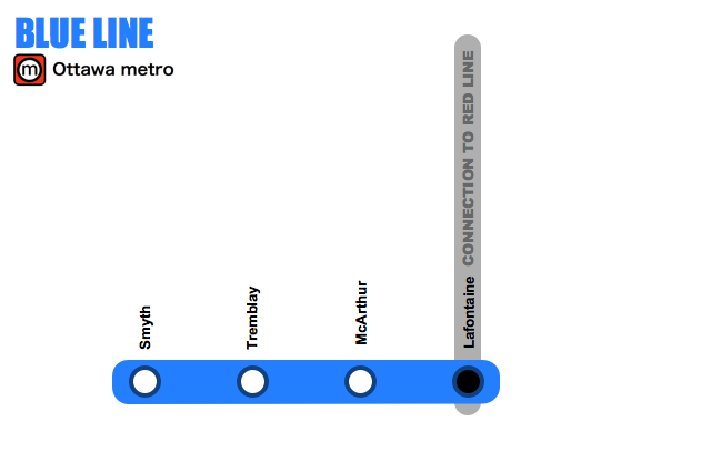
The main purpose of the Blue Line would be to connect the train station to the subway system. This line could also be expanded depending on the need for it.
The Green Line

The Green line would mostly run along St-Laurent, giving better access to a lot of the retailers along the street, including the St-Laurent Mall and also connect tourist attractions such as the RCMP musical ride and the Ottawa Science Museum.
So there you have it! Metro's have been around since 1863 (in London). There are now over 183 metros around the world. The largest one (423 km) is in Shanghai (China) and the smallest one (1.8 km) is in Haifa (Israel). However the one with the most station is in New York (468 stations, 368 km)
The current proposed metro system for Ottawa (76 stations, 63 km) would be comparable to the one in Montreal built in 1966 (73 stations, 69 km). Given that we're in the 21st century however, the system would have to be a lot more technologically advanced.
Reference : World Metro Database
When I had to take the subway to and from school in Montreal, I hated it! But I after taking the subway in Toronto a few times this past weekend, I have a new appreciation for how handy the subway is. Especially with the "underground world" at main stops, like Union Station. You can travel across the city, shop, and get something to eat without having to step outside into cold & crappy weather. And it's fast!
ReplyDeleteI used to take it all the time in Montreal (I also got to try the one in Toronto and Chicago). I didn't realize how practical it was until I moved here. It would make such a big and positive difference here.
DeleteThe only think missing here is a connection to Barrhaven and Riverside South, but that should be feasible as an extension of the Yellow Line, which is basically just the O-Train anyway.
ReplyDeleteOther than that, very cool. Although there are a lot of stubs that should probably be turned around into circles, reducing the number of cars and operators required for the system.
Thanks! Yes an expansion toward Barrhaven would work well.
DeleteThe circles could be neat. I figured that the lines would expand as the demand for it would increase. (A bit like like what happened in Montreal a couple years ago with the expansion towards Laval). So the Blue line could eventually expand towards Greely and the Green line could start following the 417 E
It's Lac Leamy, not Lemay.
ReplyDeleteOops. I was thinking in French (like someone's last name). Lol.
DeleteThanks I'll make sure I don't repeat this mistakes next time.
Is this idea on the table or is this a wish list? Cause this South End resident is sold!
ReplyDelete:) It's a wish list for now but it would always turn into reality with the help of various people
DeleteI had to map this out to see it; I made a few guesses for station location and alignment, but this is what these maps might look like on the ground: http://bit.ly/zg4j4O .
ReplyDeleteApart from the sections downtown, I'm not sure if all of the system needs to be underground. Some of the lines might be better (and more affordably) served by surface light rail, with smaller cars that board at street level.
Great job Greg! I think you're right about making only the downtown section underground, it would certainly save on cost. Mind you I do like not having to be outside in the winter :)
DeleteNice work on the Google mapping Greg! It really helps to show the breadth of the metro lines. I'd be curious to see how it lines up with the current LRT plans...
DeleteThe map is great!
DeleteThis is quite the departure from the current LRT plans. There has never been any formal support in planning documents to put rail under Bank Street. Though it seems like a natural underground transit corridor.
Also, Carling has been identified as a corridor for secondary LRT in the Transportation Master Plan and this plan does not see the Metro on Carling.
Are envisioning any other surface LRT or is what you're proposing the entire rapid transit system?
The one criticism I would have is that the entire O-Train corridor does not appear to be utilized, what about poor Preston Street?
Please let me know when/if you are running for mayor - I will campaign door-to-door to get you elected.
ReplyDeleteSeriously, Ms. Moot!
Lol! Thanks. I'm never thought about becoming a mayor. I'm not really good at politics ;) But I'm always up for solving problems and improving things with a team
DeleteBrilliant! This is such a practical and efficient plan for Ottawa transit.
ReplyDeleteThanks Pat. Glad you like it too
DeleteNice work. A few practical suggestions: 1) 500 m between many stations is pretty dense. You could probably stretch it to 1 km. 2) 7 lines is a lot. If you had to pick 3, which would they be?
ReplyDeleteOh that's hard. They each have their reason to be here :) But if I had to pick three lines :
Delete1st : Red line because it connects the entire City from Kanata to Orleans and stops on several major streets. It also includes the Scotia Bank Place and several malls.
2nd : Yellow line because it connects Ottawa to Gatineau and connects the airport to the city. Not to mention the CE Center, Lansdowne and the Museum of Civilization.
3rd : Blue line, mostly because it connects the train station to the subway of the system.
I think it would greatly increase the mobility of citizens and tourists. It would also help the economy in the long run by boosting revenues to various vendors with the increase of foot traffic
I agree, 500 m between stations is dense and would be quite expensive, plus stop-go-stop-go. I think 1 km apart would be adequate, people would have to walk or bus to the station.
ReplyDeleteWe have to no only consider the current needs of the city but plan for future needs of the city as well. The population will inevitably increase so I still believe an Ottawa metro has to be dense to work well. Especially in the core area of the city where we need to reduce the amount of traffic the most.
DeleteThat said, the average distance per station for the proposed Ottawa Metro is 1052 m, which is well within the range of other cities around the world. (ex. New York’s average is 834m, Montreal’s average is 1003 m. Here are some rough details:
Red Line ----- 39,831 m ------ 25 stations ----- 1593 m/station
Orange Line ----- 5,568 m ------ 9 stations ----- 619 m/station
Purple Line ----- 22,933 m ------ 15 stations ----- 1529 m/station
Yellow Line ----- 14,516 m ------ 16 stations ----- 907 m/station
Teal Line ----- 4,860 m ------ 6 stations ----- 810 m/station
Blue Line ----- 4,393 m ------ 4 stations ----- 1098 m/station
Green Line ----- 7,274 m ------ 9 stations ----- 808 m/station
Average for entire metro system ----- 1052 m/station
No matter what, this is the kind of project that will obviously cost a lot of money. It's a big project. Still, it's very important not to focus too much on cost and not to cut corners. It is after all a long term project that should last a very long time. Cutting corners would end up wasting money. And I imagine it's even more expensive to modify an existing system.
Love this idea -- interesting design, and I agree that a subway or combination subway+rail could make tremendous sense for Ottawa.
ReplyDeleteThe first question that came to mind was "How much will it cost, and how can we raise the money?". I found an interesting post discussing the costs of building in Toronto ($142.5 million/km) versus Madrid ($87.1 million/km), and why they were able to save so much more in Madrid for a (relatively) comparable network: http://stevemunro.ca/?p=738
If we use Toronto's cost estimate, we're looking at approximately $9 billion (or $8,977.5 million) for 63 km of subway. Of course I recognize this is a gross estimate with very little actual evidence (I'm no engineer, city planner, or transit specialist), but I thought I would try my best to get a rough ballpark. Also, just to add some context, the 2012 operating budget for the City of Ottawa is $2.5 billion and the capital budget is $850.8 million.
Can anyone refine the estimate a bit?
Thanks. It would be interesting to know how much this would cost. But it depends on so many things (type of design, managers, decision makers, construction team, etc). I wonder if it's possible without having a more detailed design for it first.
DeleteWhat comes to my mind to minimize cost is :
- a good and intelligent design for the metro
- an efficient team of experts to design, manage and construct the project
- minimize politics and red tape / quick decision making
- learn from other cities' experiences
- build the project in stages
You have my vote, too!
ReplyDeleteMore food for thought: Connecting the major hospitals to the system would also be tremendously helpful for people with mobility issues, and the large number of staff who work in those institutions (General, Civic, Montfort, QCH...).
Thanks! Yes I totally agree with connecting more major hospitals. And there is an opportunity to add more. It would help so many people.
DeleteSo far for the current design proposal the following hospitals/clinics are connected to the system :
Teal Line : Riverside Travel Medicine Clinic (Pleasant Park
Station), Bruyere Continuing Care (Dalhousie Station)
Red Line : Montfort Hospital (Aviation Station), Vincent Hospital (Bronson Station)
Purple Line : Pierre Jarret Hospital (Alexandre Taché) in Gatineau. Actually I would probably changed the name to Université du Québec en Outaouais because it’s really close (just noticed)
This will never happen in a million years. The decision was made 30 years ago to go with bus-based transit in Ottawa, thus we have the Transitway.
ReplyDeleteEven getting the current East-West LRT plan going is taking forever, because of costs. That goes from Tunney's Pasture to Blair Rd.
Cool train set though.
There's an old saying that goes: "He who says he can't and he who says he can are both usually right". I believe Ottawa can have one of the best metro systems in the world. We just need enough people to want it badly enough, step out of their shell and do what they can to make this happen. And for those involved in the process (once it starts) to put hard honest work into it and not be greedy.
DeleteInstead of focusing on why it's impossible I think we should focus on how we can make it possible instead. A couple decades ago most people though it was impossible to send a picture to a friend on the other side of the planet via a phone that's not connected to a wall in a matter of seconds. Despite that, most people do this on a regular basis with their Iphones or their Blackberrys.
In order to evolve we have to think beyond what already in place.
What is the "CE Centre"?
ReplyDeleteIt's a exhibition place located near the airport : http://www.cecentre.ca
DeleteI see. I found it out myself since then. This is a great plan. Lansdowne Park should have rail transit access. This can make the Glebe Ottawa's version of Bloor-Yorkville in Toronto.
DeleteThanks. The better the transit system, the better the city
DeleteI made a T-shirt a while back as part of an art thing where I imagined cool stuff I'd want Ottawa to have and one was a red line from Scotiabank Place to Lansdowne. http://imgur.com/K6mEI
ReplyDeleteneat T-shirt! Great way to promote something like this
DeleteThis is the first time I've ever seen a potential light rail system for Ottawa, amazing that an individual is behind the initiative, rather than the city/ncc/province. It speaks volumes about the way our decision makers think. It’s a great start; a few points to build on:
ReplyDelete- Public transit is most effective when people don’t have to make more than two transfers to complete a journey. In that sense, a web (of sorts) would improve the proposed network’s connectivity, especially because a lot of people would have to take the bus to reach a rail stop. To this end, establish connections between some of the east-west routes.
- One stop between The Palladium (insert current name) and Bronson? I agree with the creator, the red line is most important. Treat it that way. A necklace system from east to west. This ensures the opportunity to create an aggregated system (like in new york), where some trains hit every station, while others move people from the suburbs to the core quickly.
- As a commenter states, light rail for the most part, subway for the inner city. We have the land; bury the lines when the property becomes valuable enough to do so.
- Consider this as part of a wider city building initiative. We can build places rather than just transit lines. To promote accessibility and use, definitely include the hospitals (as mentioned in the comments). Emphasize stops in neighbourhoods that have existing connections; economic, demographic or otherwise.
- If you want to have more than a handful of lines, it’s useful to include numbers as well as colours. In building places rather than just a transit, a “teal” line is suspect.
- Orient the map north-south to avoid confusion, particularly among visitors.
Great blog! I'd be happy to keep the discussion going, if you're up for it.
Thanks Mickey! Imagine how much a group of dedicated people could accomplish ;).
DeleteGreat point about minimizing the number of transfer. Closing some loop seems to be a good option.
A combination subway and light rail would certainly help save money. However, in the long term, the city will most likely expand and areas currently outside the city would be more dense.
LOL. No problem with numbers. It's true that teal like is not very useful for someone who's color blind.
Great point about the orientation. If I get to do a version two of the map, I'll keep that in mind.
Thanks for your comments!